


Posts in 2020
February

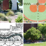
How landscape architecture adapts to climate change
February 25, 2020
Comments are off
Climate change is affecting the world in a number of different ways. Today’s landscape architects are adapting to the impacts, helping to protect the built environment against the increasing numbers and intensity of extreme events.
The American... (Read More)

Laser scanning tips
February 12, 2020
Comments are off
Laser scanning can greatly speed up surveying and provide far more information in design documents and AutoCAD drawings. But it takes more than having the tools to earn the benefits of this new technology.
Laser scanning has taken some major... (Read More)
January

Best practices for land surveying
January 29, 2020
Comments are off
Every construction or improvement project starts at the same place: with a careful, up-to-date and professional land survey. It’s an essential and accurate picture that architects, engineers and construction professionals depend on.
The key to... (Read More)

Laser scanning for oil
January 14, 2020
Comments are off
At McNeil Engineering, we’ve been using LIDAR laser scanning as a tool for civil engineering, structural engineering, surveying and building modeling for years. One of the most interesting uses was scanning the Book Cliffs in eastern Utah in a... (Read More)
Popular Posts


©2025 Social5, LLC